
Mapping the Post-WWII Housing Estate Welcome to MORE 2026
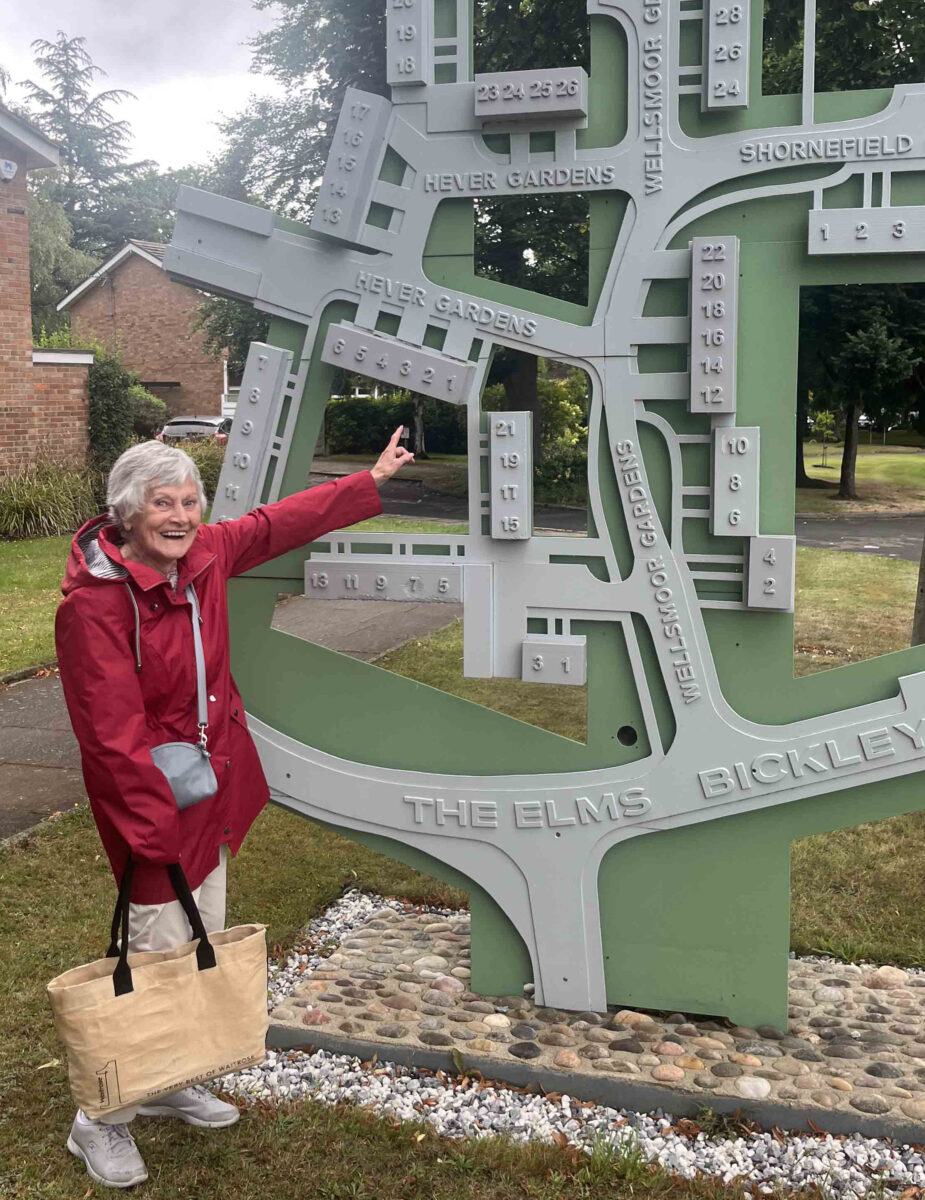
A resident of the Elms Estate, Bromley, bty the estate’s street map, designed by FHK Henrion
Lead Researcher: Jullian Wiliams
Completed in 1964, the entrance to the Elms Estate in Bromley, south London, is graced by a unique three-dimensional signboard, commissioned by the estate’s builders, Wates.
Most estate signboards follow a familiar pattern – colour-coded maps with a logo denoting the borough or housing association to which the estate belongs. Sometimes they include a prominent red dot shouting ‘You are here’, marking the visitor’s location on a simplified graphic of the estate’s blocks and pathways. These signs exist in part because public housing estates in London and across the UK were rarely included in street finder maps or A-Z books, and even now can be missing from digitally mapped space.
While the estate might be overlooked in this respect, the signboards themselves tell a different story through their very particular graphic language. The decisions of what to include and exclude from the map reveal significant cultural and political values about the estate as a broader concept.
The aluminium and steel Elms Estate map was designed by Frederick Henri Kay Henrion, responsible for many familiar post-WWII graphic logos such as those for the National Theatre and KLM. This detailed history is part of my research on the geography and culture of the estate as a place in and of itself.
KEY WORDS: housing estate; design; mapping